Topographical Survey in Ghaziabad & Dehradun

A project team deciding who will use the mapping output needs more than a list of spot levels. A topographical survey in Ghaziabad gives designers, consultants and contractors a common picture of existing ground levels and visible features before design decisions are taken. It can support DPR preparation, corridor planning and site development.

For teams working around Ghaziabad and Dehradun, the value is in making the existing site understandable before design and construction decisions are locked in.

What Is a Topographical Survey and Why It Matters

A topographical survey maps natural and man-made features, such as ground levels, roads, buildings, trees, water bodies, utilities and boundaries, on one plan. It is the base for DPRs, design and approvals on most infrastructure projects. For a project manager, that means the survey is not an isolated field exercise. It creates information that can be checked, shared and used by designers, contractors and other members of the project team.

Topographical Survey in Ghaziabad, Dehradun: Terrain, Projects and Challenges

Ghaziabad

In Ghaziabad, topographical mapping can support infrastructure corridors, expressway-related work and real estate sites where built-up surroundings sit alongside open parcels. A useful base map needs to show existing levels and visible features in a form that a designer can carry into CAD. For teams in Ghaziabad, the challenge is often coordinating a site survey with a project footprint that crosses different existing conditions.

Dehradun

Dehradun brings a different setting, with the city extending toward the Himalayan foothills. For a topographical survey in Dehradun, the field plan should allow the team to capture changing ground levels and visible features without making unsupported assumptions about slope behaviour. On hill-road, hydro or other infrastructure work, the resulting mapping can give the consultant a clearer base for design and DPR preparation. Dehradun projects should still leave slope-stability and geotechnical judgement to qualified engineers or geologists.

Our Topographical Survey Process, Step by Step

Equipment and Technology

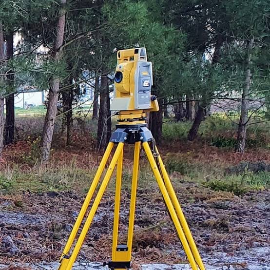
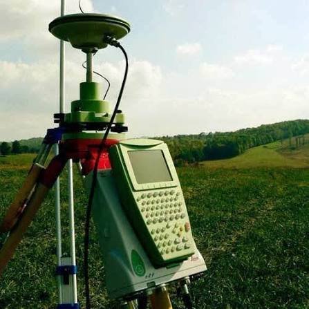
Total Station and DGPS capture detailed ground and feature information. For large areas, drone mapping can supplement ground work. The combined data is processed in CAD into a plan with contours and related design information. Related terms include Total Station, DGPS, DEM, DPR, CAD drawings, NHAI, ROW and orthomosaic.

Deliverables You Receive

Industries and Projects We Serve

Our work can support EPC contractors, consultants, developers, landowners and government departments on Base mapping for DPRs, highways, rail, dams, road widening, flyovers, utilities and township design.. The exact scope depends on the project brief, site conditions and the information the design team needs.

Cost Factors

Area or length; terrain; density of features; vegetation; survey method.. These factors determine how much field coverage, control work and processing the assignment requires. The requested deliverables also matter because drawings, reports and supporting data may require different preparation.

The topographical survey cost Ghaziabad should be understood from the actual scope rather than a generic assumption. The right scope is best defined from the site rather than from a generic topographical survey cost ghaziabad assumption. Access, terrain and the amount of information required can change the work substantially.

Why Choose Zenith Consultancy

Zenith Consultancy teams travel to site and set the method to the accuracy the design needs. For Ghaziabad, our topographical survey company Ghaziabad approach focuses on practical project requirements and useful topographical survey services Ghaziabad. Data is checked against reference points where relevant, and larger projects can be handled in stages. Reporting is in plain language, with files ready to use.

Frequently Asked Questions

What affects topographical survey cost in Ghaziabad?

Area or corridor length, terrain, feature density, vegetation and the selected survey method influence the scope. A compact developed site can require a different field approach from a long infrastructure corridor. The tender or consultant should define the required scale and accuracy rather than relying on an assumed standard.

The schedule depends on area or corridor length, terrain, feature density, vegetation, access and whether ground or aerial methods are used. Processing also depends on the amount of field information collected. A useful schedule therefore comes from the actual project extent and required deliverables.

Conditions in Ghaziabad can include the local mix of open ground, developed areas and infrastructure activity described for the region. The survey method is adapted to the actual site, including access and visibility. A topographical survey company Ghaziabad project should therefore be scoped from site conditions and required outputs rather than from location alone.

In Dehradun, a topographical survey company Dehradun can help define the local survey scope. the project setting described for this cluster can change the field approach. Terrain, access, vegetation, built-up surroundings or corridor requirements may affect control, coverage or observation. The survey should be planned around the intended project output, while specialist design or legal decisions remain with the appropriate qualified professional.

The practical answer depends on the project brief and the data the consultant needs. The survey team can explain how the requested output is produced and what site conditions may affect it. Where the issue involves engineering design, structural judgement, ownership or another regulated decision, the relevant qualified professional remains responsible for that decision.

Request a Quote

For a topographical survey in Ghaziabad, share the site location, area or length, and the deliverables required. Call or message Zenith Consultancy with the project details so the scope can be discussed.

Sign up to Privitar’s weekly newsletter to get the latest updates.

We don’t send you any spam

Copyright © Gerow| All Right Reserved