DGPS Survey Services in Ghaziabad & Dehradun

At the DPR, tender or construction stage, one important decision is how the project team will establish a common coordinate reference. DGPS survey in Ghaziabad can create ground control points that other survey activities can use as a shared reference.

Ghaziabad and Dehradun have different site contexts, from plains to Himalayan foothill areas. That makes control planning important because built-up surroundings, open ground, tree cover and terrain can affect where satellite observations can be collected effectively.

What Is a DGPS Survey and Why It Matters

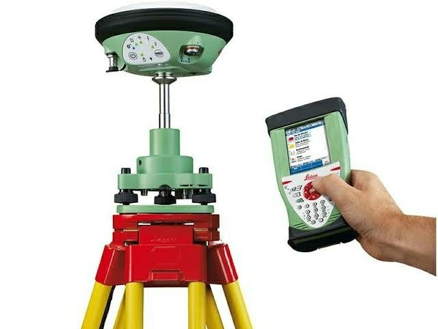
DGPS, or Differential GPS, uses satellite-based observations to establish ground control points. A base station and rover can be used for RTK work, while static observations can be selected when the project requires that method.

For a project manager, control points are the common reference behind activities such as topographical mapping, layout work, boundary surveys and drone mapping. A consistent control framework reduces the risk of different survey teams working from unrelated reference positions.

DGPS survey in Ghaziabad & Dehradun: Terrain, Projects and Challenges

DGPS survey company Ghaziabad

Ghaziabad’s plains and built-up areas can present different observation conditions within the same project. Dense surroundings may limit open sky, while open sites can provide more suitable satellite visibility. For expressway and real-estate work, control placement needs to suit the project area and the later surveys that will depend on those points.

DGPS survey in Dehradun

Dehradun sits in the Himalayan foothill region, where terrain and vegetation can vary across a project area. A DGPS survey in Dehradun therefore needs site-specific planning for control placement and observation conditions. For hill-road, hydro or slope-related work, the survey establishes coordinates, while slope stability and geotechnical judgement remain matters for qualified engineers or geologists.

Our DGPS Survey Process, Step by Step

Equipment and Technology

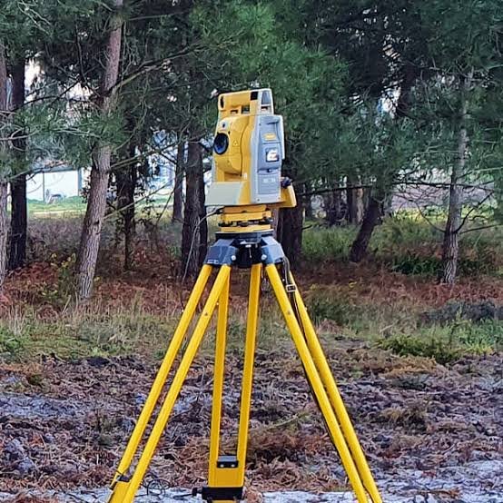
Dual-frequency DGPS/GNSS receivers support RTK base-rover or static observations. Total Station can add detail where satellite visibility is limited. CAD is used for the control layout and project drawings. The method is selected around the accuracy the project requires rather than applying one approach to every site.

Deliverables You Receive

Industries and Projects We Serve

Zenith supports EPC contractors, consultants, developers, landowners and government departments requiring control for highways, railways, infrastructure, real estate and related survey work. The control framework can also support DPR preparation, ROW-related work and subsequent topographical, layout or drone surveys.

Cost Factors

The DGPS survey cost Ghaziabad projects involve depends on the number and spacing of control points, terrain, access and the observation method selected. Static and RTK approaches can involve different field requirements.

Pillar construction and the number of drawings or reports also affect scope. The required accuracy comes from the project requirement; Zenith does not assume an accuracy figure without the relevant specification.

Why Choose Zenith Consultancy

Zenith Consultancy is a DGPS survey company Ghaziabad project teams can engage for ground control work. Our DGPS survey services Ghaziabad include teams travelling to site, a method set to the accuracy the design needs and data checked against reference points.

On larger projects, data can be handled in stages. We provide plain-language reporting and files ready to use. Coordinates establish positions; they do not determine legal ownership, which requires appropriate legal advice.

Frequently Asked Questions

What affects the cost of a DGPS survey?

Scope depends on the number and spacing of control points, terrain, access, required accuracy, observation method, pillar construction and reporting requirements. A small control network and a larger project network will therefore have different field needs. The project specification should define the required accuracy before the survey method is finalised.

The field effort depends on the number of control points, their spacing, site access, terrain and whether RTK or static observations are required. Processing and checking also form part of the work. Zenith can define the expected scope after reviewing the project location, control requirement and requested deliverables.

DGPS work in Ghaziabad can establish control points for topographical, layout, drone and related survey work. On plains and built-up sites, control placement considers satellite visibility and practical access. A DGPS survey company Ghaziabad team can also coordinate the control output with the project’s later CAD and field requirements.

For work in Dehradun, terrain and vegetation can affect where control points can be observed and placed. A DGPS survey company Dehradun can plan control locations around the site’s observation conditions. The survey provides coordinate control for project work, including hill roads or hydro-related sites. Questions about slope stability or geotechnical conditions should be addressed by qualified engineers or geologists.

Control points give different survey activities a shared coordinate reference. This matters when topographical mapping, layout marking, drone work or alignment surveys are carried out at different stages. When every activity uses unrelated references, the project team can face coordination problems. Control helps establish a common starting framework.

Request a Quote

For DGPS survey in Ghaziabad, share the site location, area or corridor length and required deliverables. Call or message Zenith Consultancy with the control requirement and project stage.

Sign up to Privitar’s weekly newsletter to get the latest updates.

We don’t send you any spam

Copyright © Gerow| All Right Reserved