DGPS Survey Services in Delhi, Noida & Gurgaon

Before setting out a highway, railway corridor or large development, a project manager has to decide whether the site can be tied to a reliable coordinate system. A DGPS Survey in Delhi, Gurgaon and Noida can establish ground control points that give later survey and mapping work a common reference.

In the Delhi NCR environment, dense construction, open ground and changing site access can affect where satellite observations are practical. The right control arrangement helps teams coordinate topographical, layout and drone work without treating each survey as a separate reference exercise.

What Is a DGPS Survey and Why It Matters

DGPS uses satellite positioning with a base station and rover, or static observations, to establish control points on the ground. These points become references for subsequent measurements, mapping and setting-out activities.

For a project manager, the value is consistency. When a DPR, ROW work, topographical survey or layout depends on coordinates, a properly planned control network helps different pieces of survey information fit the same reference system. It also creates a documented basis for later checking.

DGPS Survey in Delhi, Gurgaon and Noida, Noida & Gurgaon: Terrain, Projects and Challenges

Delhi

Delhi combines dense urban areas with open stretches and the broad Yamuna floodplain. For infrastructure and development work, a survey team must consider buildings, tree cover and restricted visibility when deciding where control can be observed. Metro, RRTS and expressway projects can require control that supports later alignment and mapping tasks. In Delhi, the control layout also needs practical access for repeated site checks.

Noida

Noida has extensive planned development, industrial plots and major transport-led construction. Open parcels can provide useful satellite visibility, while built-up sections may limit suitable observation locations. For a project in Noida, control points can support topographical mapping, site layout and drone-based data collection where those activities form part of the scope. The surrounding development pattern makes clear point descriptions and accessible locations important.

Gurgaon

Gurgaon combines dense commercial development with expanding residential, industrial and corridor-based construction. Tall buildings and tree cover can create local conditions where satellite visibility varies across a site. For infrastructure or real-estate work in Gurgaon, control planning should account for these differences rather than applying identical spacing everywhere. Gurgaon projects may also need control that can support later Total Station detail work.

Our DGPS Survey Process, Step by Step

Equipment and Technology

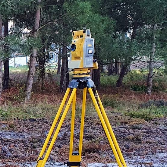
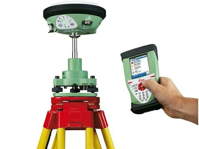
The field method uses dual-frequency DGPS/GNSS receivers with either a base-rover RTK setup or static observations. A Total Station can add detailed measurements where satellite visibility is weak. Raw observations are processed before coordinates are issued, and CAD is used for drawings.

Deliverables You Receive

Industries and Projects We Serve

Zenith Consultancy serves EPC contractors, consultants, developers, landowners and government departments working on infrastructure and development assignments. Typical applications include highway, railway, metro, RRTS, expressway, real-estate and industrial-plot projects. The control network can support related topographical, layout and drone survey activities where included in the project scope.

Cost Factors

The DGPS survey cost Delhi depends on the number of control points, required spacing and the terrain and access conditions. The accuracy requirement also affects whether RTK or static observation is appropriate.

Pillar construction, the number of drawings and reports, and the field conditions can further affect the scope. A clear site brief helps define the required control arrangement before field work begins.

Why Choose Zenith Consultancy

Zenith Consultancy is a DGPS survey company Delhi clients can approach when site work requires travel to the project location. Our DGPS survey services Delhi are set to the accuracy the design needs, with data checked against reference points where relevant.

For larger assignments, data can be issued in stages. Reporting is kept in plain language, with files prepared in formats ready to use.

Frequently Asked Questions

What affects the cost of a DGPS survey?

The cost depends on the number and spacing of control points, terrain, site access, required observation method, pillar construction and the number of drawings or reports. A site with straightforward access may require a different field arrangement from a larger or more constrained site, so scope is normally defined from the project requirement.

The field and processing duration depends on the number of points, observation method, site access, terrain and required deliverables. Static observations can involve a different field workflow from RTK work. Larger assignments may also be handled in stages, depending on how the project needs the control information.

For DGPS survey in Noida, planned sectors, industrial plots and construction activity can create different observation conditions within one site. Open areas may offer better satellite visibility, while built-up sections need careful point selection. A DGPS survey company Noida project team can plan control around the actual site conditions and intended downstream surveys.

In Delhi, control points can provide a common reference for topographical mapping, layout work and drone surveys. Dense construction and tree cover can affect where observations are practical. A project manager should therefore consider the final design and mapping requirements while deciding the number and placement of control points rather than treating control as an isolated survey activity.

For DGPS survey in Gurgaon, mixed commercial, residential and infrastructure environments can create changing satellite visibility. Tall structures and vegetation may affect point selection. A DGPS survey company Gurgaon should therefore consider the open and constrained parts of the site, the required control spacing and whether Total Station detail will be needed alongside satellite observations.

Request a Quote

For a DGPS Survey in Delhi, Gurgaon and Noida, share the site location, area or length and required deliverables. Call or message Zenith Consultancy with the project brief so the survey scope can be understood before field work.

Sign up to Privitar’s weekly newsletter to get the latest updates.

We don’t send you any spam

Copyright © Gerow| All Right Reserved