Brochure

when an unknown printer took ga lley offer typey anddey.

PDF. Download DOC. Download

If You Need Any Help Contact With Us

+91 9717087858

Get A Free Quote

    DGPS Survey in Lucknow & Varanas

    The main challenge on a large project is keeping different survey activities tied to the same coordinate reference. A DGPS survey in Lucknow establishes control points that can anchor mapping, setting-out and other measurements so project teams are working from a consistent spatial framework.

    Across Lucknow and Varanasi, open ground, built-up areas and tree cover can affect satellite observations differently. Control placement should therefore be decided from the site rather than assumed from the city name alone.

    What Is a DGPS Survey and Why It Matters

    DGPS (Differential GPS) surveys fix accurate ground control points using a base station and rover, or static observations. Control points anchor every other survey on a project, from topographical mapping to alignment marking, so all work fits one coordinate system. For a project manager, this means the survey is a project input rather than an isolated field task. The information can be shared with consultants, contractors and other teams who need a consistent picture of the existing site or the positions that must be marked.

    DGPS survey in Lucknow in Lucknow, Varanasi: Terrain, Projects and Challenges

    DGPS Survey in Lucknow

    The gangetic plains setting around Lucknow can create a mix of open parcels and developed or infrastructure-focused sites. For DGPS survey Lucknow, the field scope should reflect the actual plot or corridor and the features the project team needs measured. Lucknow work may therefore involve careful control, access review and clear separation between measured conditions and assumptions. Lucknow project teams may use this information when project teams can use control information to anchor topographical, layout, drone and other survey work.

    DGPS Survey in Varanasi

    For work in Varanasi, the wider expressways, railway, ganga corridor, urban projects context can shape the survey plan without changing the basic measurement principles. DGPS survey in Varanasi can be particularly relevant where the site forms part of a larger infrastructure or development footprint. The team still needs to review access, vegetation, existing reference information and the required deliverables before field work starts. In Varanasi, the final coverage should be matched to the design stage and the intended use of the survey files.

    Our DGPS Survey Process, Step by Step

    Equipment and Technology

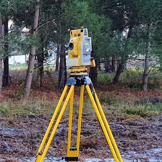
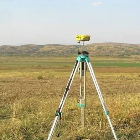
    Dual-frequency DGPS/GNSS receivers support RTK or static observation. Total Station can supplement work where trees, buildings or other obstructions reduce satellite visibility. Raw observations are post-processed and checked against reference points, with CAD used for control drawings.

    Deliverables You Receive

    Industries and Projects We Serve

    Our work supports EPC contractors, consultants, developers, landowners and government departments on Benchmark and control pillar fixing; boundary and corner point coordinates; levelling support; control for topographical, layout and drone surveys.. The same service can be scoped differently for a compact site, a larger parcel or an infrastructure corridor, depending on the project brief and the information the design team needs.

    Cost Factors

    Number of control points; spacing; terrain and access; accuracy required; static vs RTK; pillar construction; number of drawings and reports.. Area or corridor extent, terrain and access can change the amount of field work required. The number of control points, observations and drawings also depends on the project brief. For a dgps survey assignment, the requested deliverables should be agreed before field work so the scope is clear.

    The DGPS survey cost Lucknow is therefore linked to the actual site and output requirements rather than a generic location-based assumption. Vegetation, boundary clarity, feature density, construction stages or permissions may add to the work depending on the service.

    Why Choose Zenith Consultancy

    Zenith Consultancy teams travel to site and set the method to the accuracy the design needs. For Lucknow, our DGPS survey company Lucknow approach is supported by practical DGPS survey services Lucknow. Data is checked against reference points where relevant, and larger projects can be handled in stages. Reporting is in plain language, with files ready to use.

    Frequently Asked Questions

    hat affects the dgps survey cost in Lucknow?

    The main factors are the site or corridor extent, terrain, access, field coverage, control requirements and the deliverables requested. The project stage can also change the scope. For some assignments, additional drawings, reports or supporting data are needed. A clear brief helps define the work without assuming that every site in Lucknow needs the same approach.

    The schedule depends on site size, access, terrain, vegetation, the number of observations or points required and the amount of processing. Weather or permissions can also affect services involving aerial work. The intended deliverables matter because field collection and processing are separate parts of the workflow. A project-specific review is needed before a reliable schedule can be set.

    For the service on a Lucknow site, the team considers open ground, built-up surroundings and tree cover because these can affect satellite visibility. A DGPS survey company Lucknow assignment is planned around the control points, reference information and coordinate outputs required by the project.

    For DGPS survey in Varanasi, control placement depends on the actual site and the visibility available for observations. Static or RTK methods can be selected according to the required work. A DGPS survey company Varanasi project should confirm the coordinate reference and deliverables before field collection.

    The deliverables can include coordinate and control point lists, descriptions, CAD drawings and a short report, depending on the agreed scope. The project team should specify the required file format and coordinate reference before field work so the final data can be prepared for direct use.

    Request a Quote

    For a DGPS survey in Lucknow, share the site location, area or length, and the deliverables required. Call or message Zenith Consultancy with the project details so the scope can be discussed.

    Sign up to Privitar’s weekly newsletter to get the latest updates.

    [mc4wp_form id=310]

    We don’t send you any spam

    Copyright © Gerow| All Right Reserved

    Zenith Consultancy provides survey and site investigation services for buildings, railway, highway, dam, transmission line and all types of Infrastructural projects.

    Copyright © 2026 Zenith Consultancy