 NK Mehta
Most people picture offshore wind as giant white turbines turning against a grey sky. However, the most demanding engineering often happens years before those towers appear. Offshore wind farm seabed surveys decide where turbines can stand, how deep foundations must go and which routes the export cables can safely follow.
In simple terms, developers cannot build on ground they have never seen. The seabed is dark, shifting and full of surprises, from buried boulders to old wartime munitions. As a result, survey vessels spend months mapping, sampling and testing the sea floor before engineers draw a single foundation.
Why Offshore Wind Farm Seabed Surveys Come First
A modern offshore turbine can weigh thousands of tonnes and must survive storms for 25 to 30 years. Because of this, its foundation has to suit the exact ground beneath it. Soft clay, dense sand and hard rock each demand a different design.
Site investigation usually runs in stages. Early desk studies review existing charts, geological maps and past survey data. Next, wide-area geophysical surveys build a picture of the whole site. Finally, targeted geotechnical work tests the soil at each planned turbine position.
This phased approach saves money. In fact, a poorly understood seabed is one of the biggest causes of cost overruns and delays in offshore construction. Good survey data also supports permits, insurance and investor confidence.
- Desk study: reviews charts, geology and historic records
- Geophysical survey: maps the seabed and shallow layers over the full site
- Geotechnical survey: samples and tests soil at specific locations
- Environmental survey: records habitats, species and sensitive features
How Engineers Map the Seabed With Sound
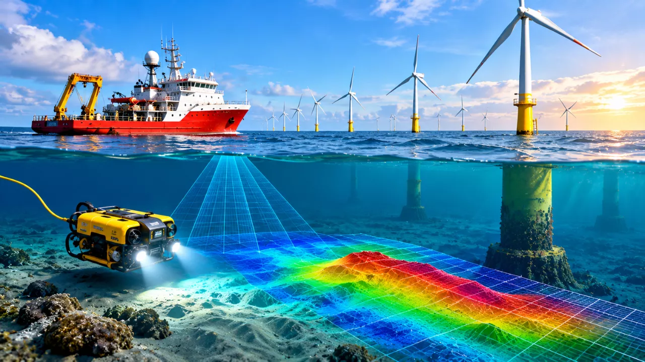
Light fades quickly underwater, so survey teams rely on sound instead. Vessels and remotely operated vehicles send acoustic pulses downward and measure the echoes. Together, these signals reveal the shape of the sea floor and the layers hidden beneath it.
Each instrument answers a different question. For example, a multibeam echosounder measures water depth, while a sub-bottom profiler looks below the surface. Combined, they produce a detailed 3D ground model of the site.
| Survey tool | What it does | Why it matters for wind farms |
|---|---|---|
| Multibeam echosounder | Measures water depth across a wide swath | Creates high-resolution bathymetry maps for layout planning |
| Side-scan sonar | Images the texture of the seabed surface | Spots boulders, wrecks, sand waves and debris |
| Sub-bottom profiler | Sends low-frequency sound into shallow sediments | Reveals buried layers and channels under turbine sites |
| Magnetometer | Detects changes in the magnetic field | Finds metal objects such as unexploded ordnance and old cables |
| Seismic reflection | Images deeper geological structures | Supports foundation design for large monopiles |
| Cone penetration test (CPT) | Pushes an instrumented cone into the soil | Measures soil strength directly at turbine positions |
Geotechnical Investigations: Testing the Ground Itself
Maps show what the seabed looks like, but they cannot confirm how strong it is. That is where geotechnical investigation steps in. Specialist vessels hold position over each planned turbine and drill or push tools directly into the ground.
Cone penetration tests are the workhorse of this stage. A steel cone fitted with sensors is pushed into the soil at a steady rate. Meanwhile, it records resistance, friction and water pressure in real time.
Boreholes add another layer of certainty. Engineers recover core samples and send them to laboratories for strength, density and grain-size testing. Similarly, shorter vibrocores sample loose surface sediments along cable routes.
What engineers learn from soil samples
- How deep a monopile or suction bucket must be installed
- Whether piles can be driven or must be drilled into rock
- How the ground may behave under repeated wave and wind loading
- Where scour protection is needed around the foundation base
Hidden Hazards: Unexploded Ordnance, Boulders and Cable Routes
Some seabed risks have nothing to do with soil strength. In waters such as the North Sea and Baltic Sea, decades-old bombs, mines and shells still lie on or beneath the sea floor. Consequently, unexploded ordnance (UXO) surveys are now a standard step before construction begins.
Teams first use magnetometers and sonar to flag suspicious targets. After that, remotely operated vehicles inspect each contact up close. Confirmed items are then moved, avoided or safely cleared by specialists.
Boulders create a different problem. Even one large stone can block a cable plough or damage a jack-up vessel’s legs. For this reason, contractors often run boulder clearance campaigns along cable corridors before installation.
Protecting marine life along the way
Environmental surveys run alongside the engineering work. Biologists use seabed grab samples, drop-down cameras and video transects to record habitats. These findings help developers avoid sensitive areas such as reefs, seagrass beds and fish spawning grounds.
How Survey Data Shapes the Final Wind Farm Design
All of this information flows into one integrated ground model. Geologists, geotechnical engineers and designers use it to fine-tune the layout. Sometimes a turbine shifts by a few hundred metres simply to avoid a buried channel or a cluster of boulders.
The data also guides foundation choice. Monopiles suit many sandy and clay sites, whereas jackets or suction buckets may work better elsewhere. In deeper water, floating foundations rely on survey results to plan mooring lines and anchors.
In the end, the survey phase is quiet, slow and largely invisible to the public. Yet it is the reason offshore wind farms can stand safely for decades. Every turbine you see on the horizon rests on months of patient work carried out in the dark beneath the waves.