Brochure

when an unknown printer took ga lley offer typey anddey.

PDF. Download DOC. Download

If You Need Any Help Contact With Us

+91 9717087858

Get A Free Quote

    DGPS Survey Services in Ahmedabad & Bhopal

    At the end of a DGPS survey in Ahmedabad or Bhopal, you hold a list of control points with coordinates, a description of where each one sits and a drawing of the layout. Every consultant and contractor can then measure from the same fixed points. Zenith Consultancy serves EPC contractors, consultants, developers and government departments across the region.

    Our survey teams travel to site and set the method to the accuracy your design needs. This page explains what the survey involves, how plains and corridor projects shape it and what you receive.

    What Is a DGPS Survey and Why It Matters

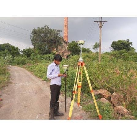
    DGPS stands for Differential GPS. A base receiver sits on a known point and compares satellite signals with a rover receiver moving across the site. The difference corrects the rover’s readings, so each point is tied to one coordinate system.

    These fixed points are called control points. Topographical mapping, alignment marking and layout work all start from them. For a project manager, shared control means fewer disputes between teams and less rework.

    A DGPS survey fixes positions. It does not decide who owns land, which a qualified lawyer must advise on.

    DGPS Survey in Ahmedabad & Bhopal: Terrain, Projects and Challenges

    Ahmedabad

    Ahmedabad sits in a region of plains and industrial corridors, so DGPS work often runs along long, open alignments. Rail corridors and industrial parks need control points repeated at regular spacing, so errors do not build up. Open ground generally gives a good sky view, which suits base-rover work. Around built-up edges, we check each point against known reference points.

    Bhopal

    A DGPS survey in Bhopal commonly supports new city projects, industrial parks and road or rail work. Large new sites need a control network that every package can share, from early mapping to layout. Where trees or buildings limit the sky view, we add Total Station work from the fixed points. Bhopal teams then work from one reference.

    Our DGPS Survey Process, Step by Step

    Equipment and Technology

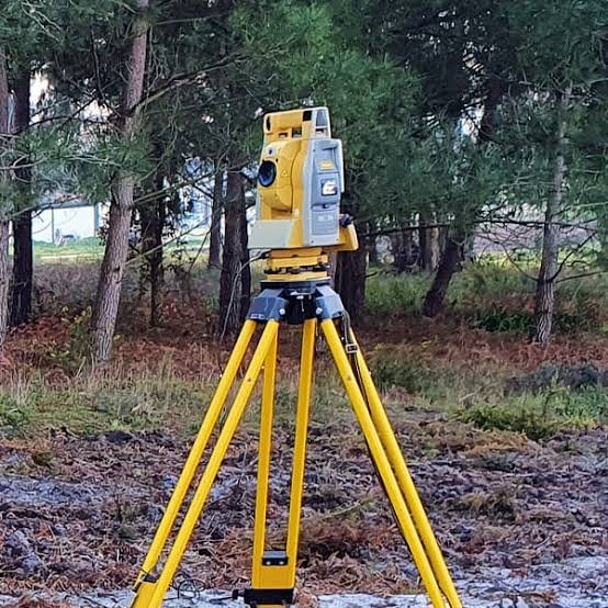
    We use dual-frequency DGPS/GNSS receivers in base-rover (RTK) or static mode, depending on the accuracy the project needs. Static observation takes longer but suits critical control. Post-processing software cleans the data. A Total Station adds detail where buildings or trees limit the sky view, and CAD software produces the drawings.

    Deliverables You Receive

    Industries and Projects We Serve

    We work with EPC contractors, consultants, developers and government departments. In Ahmedabad and Bhopal, DGPS control typically supports rail corridors, industrial parks and new city projects. Consultants preparing a DPR often need control early, so later topographical and alignment surveys fit together. Road teams also use control to mark the right of way (ROW) on the ground.

    Cost Factors

    We do not use a flat rate for every site. When you compare quotes for DGPS survey cost Ahmedabad projects, check what each one includes.

    The main factors are the number of control points, the spacing between them, site access and the accuracy required. Static observation, pillars and the number of drawings and reports also affect the price. Send us the location, length and scope, and we will share a quotation.

    Why Choose Zenith Consultancy

    A DGPS survey company Ahmedabad clients can brief should explain its method and show how data is checked. Zenith Consultancy works this way.

    We deliver DGPS survey services Ahmedabad and Bhopal teams can use directly, in plain language.

    Frequently Asked Questions

    What decides the price of DGPS control on a corridor project?

    Price depends on the number of control points, their spacing along the corridor, site access and the accuracy required. We do not charge a flat rate for every site. Share the location, length and scope, and Zenith Consultancy will send a written quotation.

    Time depends on the number of points, the length of the corridor, access, weather and the method used, since static takes longer than RTK. We confirm a schedule in the quotation. On larger projects we can share coordinates in stages.

    Yes, we set control points at regular intervals along the corridor and check each against known reference points. Every package then shares one reference. Send us the route and the accuracy your design needs, and we will plan the survey.

    Yes, Zenith works as a DGPS survey company Bhopal clients can brief directly. We build a control network that mapping, layout and road teams all share. Send us the site extent, the scope and your construction phases, and we will plan the points.

    Poor sky view weakens satellite signals. We place control on open ground and clear rooftops, then add Total Station measurements from those points to cover the gaps. Each point is checked against known reference points before coordinates are issued to your team.

    Request a Quote

    Planning a DGPS survey in Ahmedabad or Bhopal? Share your site location, route length and the deliverables you need. Call or message Zenith Consultancy, and we will respond with a quotation.

    Sign up to Privitar’s weekly newsletter to get the latest updates.

    [mc4wp_form id=310]

    We don’t send you any spam

    Copyright © Gerow| All Right Reserved

    Zenith Consultancy provides survey and site investigation services for buildings, railway, highway, dam, transmission line and all types of Infrastructural projects.

    Copyright © 2026 Zenith Consultancy