 NK Mehta
Zenith Infra Group · Infrastructure Insights · November 2026
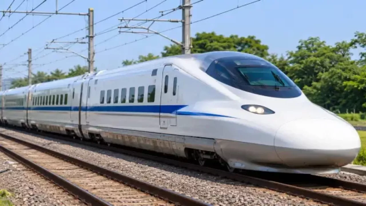
On 31 October 2026, Railway Minister Ashwini Vaishnaw announced that Prime Minister Narendra Modi has approved the Northern Corridor of India’s bullet train network. The headline number is hard to ignore: Delhi to Agra in 59 minutes. But for those of us who work on the ground in infrastructure, the more interesting question is what has to happen before a single pillar goes up. The answer starts with survey.
What has been announced
The Northern Corridor is planned to start in Delhi and run through Agra, Kanpur, Lucknow, Ayodhya, Prayagraj, Varanasi, Patna and Siliguri, eventually extending to Guwahati. Reports describe it as a line of roughly 1,500 km across Uttar Pradesh, Bihar and West Bengal into Assam.
Projected journey times once it is operational:
| Route | Projected time |
|---|---|
| Delhi – Agra | 59 minutes |
| Delhi – Kanpur | 1 hr 45 min |
| Delhi – Lucknow | 2 hr 12 min |
| Delhi – Varanasi | 3 hr 33 min |
| Lucknow – Varanasi | 1 hr 21 min |
The corridor is one of seven high-speed rail corridors announced in the Union Budget 2026-27, which together add up to a proposed network of nearly 4,000 km. The minister also stressed that construction, from pillar to girder, is to be made in India.
It is worth being precise about the stage the project is at. As of now, no final detailed project report (DPR), sanctioned cost or construction timeline has been published. Earlier reporting on the Delhi–Varanasi section put it at around 865 km and nearly ₹2.3 lakh crore, and noted that NHSRCL had started identifying land parcels for stations near Mathura and Agra. In other words, the corridor is moving from vision to engineering, and that is exactly where survey work becomes critical.
Before the first pillar: the survey work behind a high-speed line
A bullet train is unforgiving. At 300+ km/h, curves, gradients and track geometry must be held to very tight tolerances, and every design decision downstream depends on how accurately the ground was measured. On a corridor of this scale, the survey programme typically includes:
- Geodetic control network (DGPS): A dense, high-accuracy network of control points along the full alignment, so that every design drawing, contractor and construction package works off the same reference.
- Topographic and contour surveys: Detailed ground models of the corridor, station areas and depots, used for alignment design, earthwork estimates and drainage.
- Aerial LiDAR and drone surveys: For long linear projects, aerial LiDAR has become the standard for capturing terrain fast. The Mumbai–Nagpur high-speed corridor, for instance, began with an aerial LiDAR survey. Drones then fill in detail at stations, river crossings and congested urban stretches.
- Alignment and layout surveys: Staking out the centreline, pier locations, viaduct footprints and station structures on the ground with Total Station precision.
- Soil investigation: Boreholes and lab testing to design foundations for viaducts and stations, especially important across the alluvial plains of the Ganga basin.
- Hydrological surveys: The corridor crosses major rivers including the Yamuna and the Ganga. Flood levels, river behaviour and bridge-site studies all feed into safe crossing design.
- Land and utility mapping: Accurate boundaries for land acquisition, plus mapping of existing roads, power lines and pipelines that the alignment must cross or avoid.
Errors at this stage are expensive. A shifted alignment or an under-estimated soft-soil zone can mean redesigns, delays and cost overruns years later. Good survey data is the cheapest risk control a project of this size can buy.
What it means for North India’s infrastructure ecosystem
Beyond faster travel, high-speed corridors tend to reshape the land around them. Planned stations near Agra and Mathura are already being discussed as anchors for integrated residential and commercial development, linked to the Yamuna Expressway industrial townships. That means survey demand will not stop at the rail line itself: station-area master plans, access roads, utilities, and private real estate around each hub will all need reliable ground data.
For NCR and Uttar Pradesh in particular, this adds to an already deep pipeline of rail, metro, RRTS and expressway work. The firms that will be useful in that pipeline are the ones that can deliver accurate data quickly, in the formats engineering teams actually use.
Where Zenith Infra Group fits in
Zenith Infra Group works on exactly this foundational layer of infrastructure. Our team provides topographic surveys, DGPS control, Total Station layout, transmission line surveys, soil investigation, drone surveys and hydrology for railway, dam and highway projects.
Railway work is part of our track record: at Shakur Basti railway station in Delhi, we carried out topographical and layout surveys covering the station periphery, platform structures, sheds and column layout, the underpass, and the railway track alignment. On a 196 MW hydro project in Kullu, we delivered topographic and contour surveys on steep, densely vegetated terrain, along with layout of the dam structure, diversion channel, bridge and road.
As the Northern Corridor and the projects around it move into detailed design and construction, contractors, consultants and developers will need survey partners who understand both precision and pace. That is the work we do every day.
Planning a rail, highway or infrastructure project in North India? Talk to Zenith Infra Group about your survey requirements.
Sources: Business Standard / PTI, IANS (via Morung Express), Square Yards, Swarajya, Transclew. Project details are as reported on 31 October 2026 and may change once the DPR and official sanction are published.